You may or may not remember that the last hike looked into here focused on the Thompson Island sandbar, a spit of land that allows you to literally walk across Boston Harbor at low tide. And yes, the sandbar may be spectacular, but if you’re one of those people who lives for elevation gains, that hike ain’t it, as standing on a dictionary would give you more of an elevation gain than doing that walk. Only a few miles away, however, is a trail that will give you the type of climbing more typically found 120 miles to the north in New Hampshire’s White Mountains, and the Skyline Trail in the Blue Hills Reservation is indeed used by many to train for difficult hikes up in the Whites.
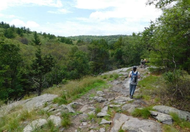
The Skyline is a mostly rugged and remote path that goes from the Shea Rink in West Quincy westward all the way to the Route 128/95/93 intersection in Canton, cutting through the heart of this 7,000-acre park. Depending on the number of spurs you take for viewpoints—and whether you take the North Skyline or the South Skyline branch as you approach Great Blue Hill, you’ll probably get about 9 miles of hiking in and a total of 2,000 feet in total elevation gain, which is about what you’d get by hiking Cannon or Wildcat in New Hampshire (both of which are serious mountains).
Now, you may be asking yourself, “Once I get to the western end of the Skyline, what do I do then?” Well, you could go to the nearby Hillside Pub and drink until they kick you out, but that wouldn’t get you back to the start. A less fun but better plan would be to spot cars at each end if you’re driving, or Uber it back to the Shea Rink when you’re done (or drink at the Hillside Pub until you no longer feel the need to worry about such things). As an Appalachian Mountain Club leader, I personally tend to go with spotting cars here, so while it’s a bit of a pain driving both cars to the Route 138 park-and-ride and then piling in one car to drive to the rink, it’s well worth doing unless you feel like hiking 18 miles in one day, which, believe it or not, some people who are a bit off their rocker actually do.
Starting at the Shea Rink may seem a little underwhelming since, well, you’re starting from a rink, but as soon as you hit the trailhead of the white-blazed Skyline Trail, the peace and quiet immediately takes over. Within a few minutes you’ll walk past the pristine St. Moritz pond, which is where people used to ski jump long ago, then you cross Wampatuck Road and start climbing, continuing to follow the white markers/blazes, soon arriving at Rattlesnake Hill.
Now, this hill can be rather frightening, not because of the name—it is unlikely, though not impossible, that you will see a rattlesnake here—but because of the steep drop-off heading down the hill. Just before hitting the drop-off, look for a tiny trail on the left that goes up some rocks and you’ll be rewarded with remarkable views of woods and distant hills from the cliffs and ledges, which basically represent the summit of Rattlesnake. After dropping to the valley below, you’ll start climbing again, and in a few minutes you’ll find yourself at the top of Wampatuck Hill, which has some nice views mainly to the south, then it’s another steep drop to Chickatawbut Road where it’s time to do a second road crossing into another part of the park.
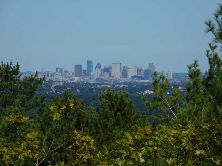
Crossing the road, you’ll immediately hit another steep climb up a hill with open views, then you drop down again before starting a long stretch of mostly climbing and, approximately three miles from the start, you’ll find yourself at the top of Nahanton Hill. The summit itself has no real views, but at Marker #3103, you should notice a minor trail that forks off a bit to the right. Take this trail for about 100 yards where you’ll emerge at a ledgy area with incredible views of Boston, the ocean, and endless woods and hills in the distance.
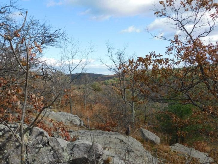
If this timing is right, this is an excellent place for a lunch/snack break before returning to the Skyline Trail and continuing on, dropping steeply to a major intersection then doing a long climb up to the top of Chickatawbut Hill, which is more than 500 feet above sea level (which is a lot for a hill so close to the ocean). Much of this massive hill is fenced off from the public, but some real wilderness views can be had along the trail as you do a series of drops, including views where you really won’t see any signs of civilization at all. It is at this point—perhaps at the top of the second drop—that marks a good turning-around option if you don’t want to do the entire Skyline. For those continuing on, the second drop is a doozy and will take you to a low valley and soon, Route 28, which cuts through the Blue Hills.
By now, you’re probably pretty tired, but you’ll need a second wind because the hike from Route 28 up to Buck Hill is a bear of a climb, though it is so worth it once you emerge from the woods and realize that you have a nearly 360 degree view, which is pretty much unheard of in the local area. Here you’ll see Boston, the ocean, and the surrounding hills, including a view looking west along the trail that has a real wilderness feel to it. Leaving the windswept summit, it’s yet another steep drop-off then some climbs and further drops to the base of Tucker Hill. Climbing Tucker is, well, no fun, really, as it is almost impossibly steep, but you’re rewarded with some views from the top before dropping down and crossing Hillside Street at the reservation headquarters. It is at this point, by the way, that you need to make a decision.
As hinted at earlier, the Skyline Trail breaks into a “north” trail and a “south” trail at the headquarters, with the former being a difficult path with some of the best views in the entire park, while the latter is generally easier but is not as scenic. The North Skyline is what we recommend here (sorry about that), and yes, you’ll have to deal with a real leg-burner the minute you leave the headquarters, as the south face of Hancock Hill is really something—a rocky, worn-out path that should not be taken lightly.
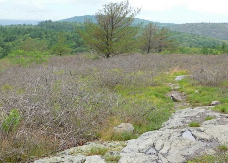
Once you get to Marker #1172, however, it’ll all be worth it, since the views from here are jaw-dropping and the ledges make for another perfect snack (or lunch) spot. A handful of beautiful trails can be found at the top of Hancock, but they’re often overgrown and pretty confusing, so it’s best to move on unless you really know the area. Staying on the Skyline, you’ll eventually drop down to a pass or notch between Hancock and Hemenway, then it’s an easy climb to the latter, which is about as far from any road as you’ll get in the park, making it a particularly quiet and peaceful place—and with more great scenery, including glimpses of the rapidly approaching Great Blue Hill.
From the third and final ledgy area on Hemenway, it’s another steep drop down to one of the biggest intersections in the park, then a gradual climb up Wolcott Hill, which has no views but does have yet another steep drop-off heading down it. Once at the bottom, you will basically be at the base of Great Blue Hill, with a seemingly endless steep climb getting you to the summit where you’ll find an old stone bridge, a weather observatory, a tower with views of mountains as far away as Western Massachusetts, and lots more.
Great Blue is a fascinating place, and at nearly 650 feet in height, it has spectacular vistas from several vantage points, so if you have time, definitely try to do some exploring. The summit, by the way, is where the north and south Skyline trails join up once again, and the now-sole trail drops down a long way to Route 138, with more outstanding views from the top just below the observatory. Crossing Route 138, the path skirts Little Blue Hill, drops down into a wooded area, and ends rather unceremoniously around the Route 128/95/93 intersection. To be honest, unless you really want to say you did the entire Skyline, stopping at Little Blue—and wandering some of the trails there, including up to the open summit—isn’t the worst of ideas, but because there is so little of the trail left after Little Blue, it’s kind of worth it just to knock off the rest before heading back to the park-and-ride and driving back.
The Skyline Trail is by no means for beginner hikers, but for anyone who has done any hiking in the mountains of Northern New England, it shouldn’t really be too bad. There really is no path quite like it in the Greater Boston area, and if you’re into bragging, you can tell people in the bars later on (maybe at the Hillside Pub, though they’ve heard it all a thousand times before) that you climbed ten hills in one day and lived to tell about it—and maybe mention the 9 miles and 2,000 feet in total elevation and all the fictitious bears and snakes you saw while you’re at it.
DIRECTIONS TO EASTERN END OF SKYLINE TRAIL: DRIVING FROM BOSTON—SE EXPRESSWAY TO EXIT 8 IN QUINCY, GO SOUTH 0.6 MILES TO SHEA RINK (WHERE TRAILHEAD IS) AT 651 WILLARD ST. PUBLIC TRANSPORTATION—RED LINE TO QUINCY ADAMS, THEN BUS #238 TO SHEA RINK. MAP OF BLUE HILLS: MASS.GOV/EEA/DOCS/DCR/PARKS/TRAILS/BLUE-HILLS-TRAIL-MAP-2016.PDF

Marc is the founder of @hiddenboston, a textbook editor, a hike leader for @AppMtnClub, and a food and travel writer and commenter for DigBoston, NBC/NECN, WBZ, WMFO and indie617.