All photos by Marc Hurwitz
Sunny walks and hikes around the region for anyone tired of the cold
It’s an understatement to say that this has been a very long winter, with endless numbingly cold nights, a few nasty storms, and, of course, the omicron surge giving yet another reason to stay indoors. But there are now signs of hope, as the sun is getting higher in the sky, the temperatures are starting to rise, and COVID seems much less of a worry than it was just after the holidays. Not everyone is ready to go back to seeing live music, attending conferences or seminars, or spending hours in museums just yet, however, making outdoor activities remain a good option for many.
As you may recall, over the past two years we’ve looked at a number of local hikes and walks in quiet areas, and this article continues in that vein, though this time, rather than focusing on the journey, we instead look at the destination itself. Below you will find a handful of places that are perfect for kicking back and feeling the sun on your face while enjoying a bite to eat, maybe a book, and, as always, the type of peace and quiet that’s good for the soul in these trying times. And all of these happen to be on or near lakes or ponds, which only makes for a greater overall experience.
Aaron River Reservoir, Cohasset
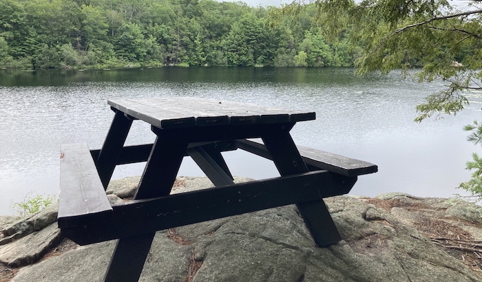
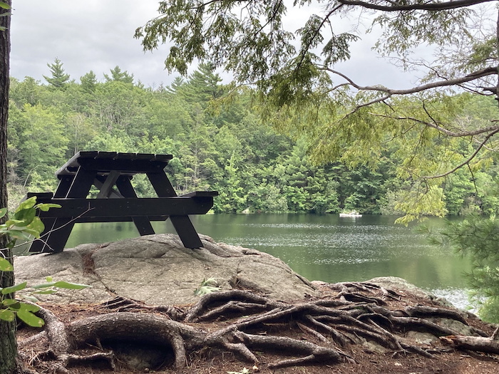
Residing mainly in Wompatuck State Park, this large and mostly remote body of water is a bit of a hidden gem in part because most people who hike this massive conservation area tend to stick close to the visitor center on the other side of the park. Hiking the trails along the Aaron River Reservoir is a memorable experience in of itself, with its many views of the water and low hills surrounding it, but there’s also a secret place near its northwest corner that happens to be one of the greatest lunch spots for hikers in the entire Boston area.
Right in the middle of the woods and overlooking the reservoir is a picnic table that seems to be balancing on the rocks above the water, and if you go in the middle of the day, you’ll be blessed with endless sunshine, which just begs for a picnic lunch, some reading material, or any other excuse to keep you at this wonderful spot for a good amount of time.
Just don’t spend too long there because continuing on the waterside trail will eventually bring you to another hidden spot—a cascading river at the Aaron River Reservoir Dam that basically marks the end of the trail, which means you’ll get a second chance to hit the balancing picnic table before heading back to the parking lot.
[GPS coordinates for picnic table: 42.2116343,-70.8299898; park at transfer station in Wompatuck. More info: mass.gov/locations/wompatuck-state-park]
Horn Pond Mountain, Woburn
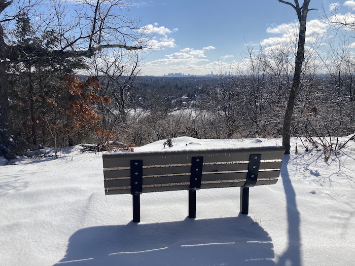
Let’s be honest—there really aren’t any mountains in the Greater Boston area, though there are some “wannabe” peaks that have the term in their names for one reason or another. And some of these so-called mountains turn out to be your classic “bang for your buck” hikes where you don’t have to expend a whole lot of effort to get some great views along with a decent amount of serenity. Horn Pond Mountain—which is also known as Mount Towanda—is just such a spot, being less than 10 miles from Downtown Crossing but having the rugged feel of a hill that’s steep enough for skiing (and a ski area actually existed here years ago). Horn Pond itself is a popular park for dog walkers, joggers, and those who simply want to get some fresh air and water views, but many if not most never climb Horn Pond Mountain even though it’s so close to the main loop around the body of water.
A steep paved road winds its way to the summit, and you can also take narrow dirt paths off the road for the climb, with both the road and trails meeting up again at an overlook near the actual summit that includes a bench and a rocky ledge, both of which feature jaw-dropping views of both Winchester and the Boston skyline. Both the bench and the ledge face southward, which means you could get a tan (or burn) even on a late winter or early spring day, so bring some sunscreen if you plan to stay up at this special spot for a little while.
[GPS coordinates for overlook: 42.4593917,-71.1571213; park in lot on Lake Avenue or along Sturgis Street on other side of pond. More info: woburnrec.com/forms/6048_walking_woburn_horn_pond_map_final.pdf]
Hillside Pond, Milton
The Blue Hills Reservation is a massive area just south of Boston that includes 7,000 acres of wilderness and miles of paths that range from very easy to some of the most challenging trails in Eastern Massachusetts. And while places such as Great Blue Hill, Houghton’s Pond, and the Chickatawbut area are often packed with people (even in the dead of winter), there are plenty of great places to escape the masses, including some spots that are literally along the side of the road. One of the best is Hillside Pond, which is hidden away in a little valley just east of Houghton’s Pond and the Blue Hills headquarters, and because its tiny parking area sits on the side of a lesser-traveled part of Hillside Street (which eventually meanders into a residential part of Milton), very few people seem to know about this section of the Blue Hills.
If you aren’t into hiking, you can simply park here and walk a few hundred feet along the northern edge of the pond. It’s much more fun, though, to park at Houghton’s Pond, wander up such beautiful peaks as Tucker Hill and Buck Hill, then drop down to Chickatawbut Road, which you cross, and work your way over to the pond from the other direction. Whatever you decide to do, you’ll be greeted by an unspoiled pine-shaded rise above Hillside Pond with an open area at the water’s edge that’s a favorite lunch spot for the Appalachian Mountain Club’s Local Walks and Hikes group, as not only do you get full sunshine in the colder months, but you’re also protected from the wind by the dense woods surrounding the water.
[GPS coordinates for Hillside Pond’s northern edge: 42.2186952,-71.0859523; park along Hillside Street, just north of where it meets Chickatawbut Road, or for a longer hike, park at the Houghton’s Pond lot. More info: mass.gov/locations/blue-hills-reservation]
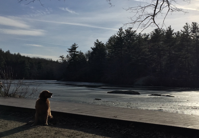
Ice Fort Cove, Concord
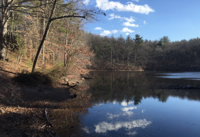
Walden Pond doesn’t usually conjure up memories of peace and quiet—especially in the summer when the place can get absolutely jammed with sunbathers and swimmers—but it tends to be a much quieter spot in the off-season, and the far end of the pond tends to have a lot more elbow room all year long. The part of Walden Pond at the far end that abuts the commuter rail tends to be particularly quiet (and on weekends the trains don’t run very often), and the northwest corner actually has its own name that almost no one knows other than maybe historians and locals.
So what’s so special about Ice Fort Cove? Well, if the water level isn’t unusually high, you’ll find a little beach there, and since it’s mostly open with relatively few trees, you can sit on a log, a rock, or the sand and catch some rays for much of the day. Because it’s sheltered from winds coming from the west, north, or south thanks to the deep woods surrounding Walden Pond, it tends to be pretty placid even on the breeziest of days.
By the way, in case you were wondering about the name, ice used to be harvested at Walden Pond many years ago, like so many bodies of water in the Greater Boston area and elsewhere in New England.
[GPS coordinates for Ice Fort Cove at Walden Pond: 42.4390507,-71.3452112; park in the Walden Pond lot on Route 126 in Concord, or for a longer hike, at the Lincoln Public Schools or the Lincoln Train Station (both of which are off Lincoln Road in Lincoln). More info: mass.gov/locations/walden-pond-state-reservation]
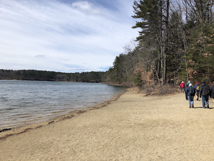
Pearce Lake Beach, Saugus
Much like Walden Pond, the beach at Breakheart Reservation can get extremely crowded on hot summer days, but also like Walden, if you go in the winter or early spring, you could have the entire beach to yourself (and maybe a dog walker or two). Known as both Pearce Lake Beach and Breakheart Beach (and Pearce Lake is also called Lower Pond just to confuse people even more), this little strip of sand includes park benches, boardwalks and docks, and rocky ledges, all of which directly face the sun in the middle of the day as the beach sits on the north side of the lake. And because Pearce Lake is surrounded by hills (including Eagle Rock, which rises directly across the water from the beach), it isn’t usually all that windy so if the weather is even half-decent, the beach is a tremendous place to while away the day.
If you get a little restless, you have some options here, including climbs up Eagle Rock, Castle Rock, Rocky Hill, Breakheart Hill, and the extremely hidden Crow Hill; a walk along Pearce Lake and Silver Lake; or for a remote hike with very few people, the Fox Run Trail—and a stop in the visitor center is a must, especially if the fireplace is going.
[GPS coordinates for Pearce Lake Beach: 42.492517,-71.0358701; park in the Northeast Metro Tech High School lot on Hemlock Road in Wakefield or at the visitor center on Forest Street in Saugus. More info: mass.gov/doc/breakheart-trail-map]
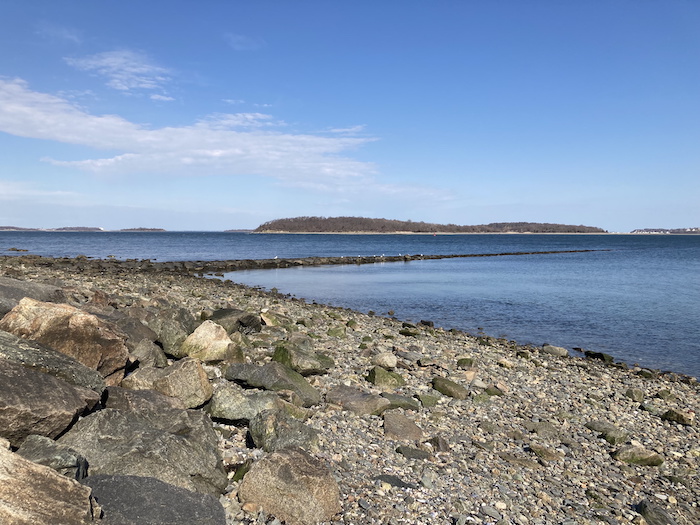
Nut Island, Quincy
A former island that has been connected to the mainland and is now technically a peninsula, Nut Island is part of the Boston Harbor Islands National Recreation Area, and it’s so far out to sea that it has the feel of a remote island in some ways. Getting to Nut Island is easy if you drive down Sea Street from near Quincy Center all the way out to Houghs Neck, but you can also hike much of the way there via a long MWRA dike that mostly parallels Sea Street just to the south and has fine views of the nearby salt marshes. Most people do opt for the drive, though, and a few parking spaces can be found at Nut Island near the fishing pier that marks the end of the peninsula. But as beautiful as the pier is with its sweeping views of the ocean and the Boston skyline, take a little detour by bearing left as you leave the pier and heading up a walkway that soon brings you to a staircase down to the water.
Going down the stairs takes you to a remarkable spot that you’ll likely have to yourself, and if the tide is out, you can walk on a jetty far out into the ocean before returning to the base of the walkway. Between the large rocks for sitting, the sun baking down on the rocks, and the majestic views of Boston Harbor, you probably won’t want to ever leave this spot, but fortunately it’ll always be here for you to return to.
[GPS coordinates for staircase: 42.2791274,-70.9533705; park by the Nut Island fishing pier. More info: bostonharborislands.org/nut-island/]

Marc is the founder of @hiddenboston, a textbook editor, a hike leader for @AppMtnClub, and a food and travel writer and commenter for DigBoston, NBC/NECN, WBZ, WMFO and indie617.