Amazing socially distanced walks in the woods near Boston
Over the past several months, we’ve looked at places where you can “GTFO,” including remote conservation lands, high hills near the city, and difficult-to-find coastal spots, with the emphasis being on taking walks and hikes while keeping away from people as the pandemic continues. There happen to be a lot of fun walks in residential areas as well, and these tend to be much easier to get to if you don’t have a car and are OK with taking public transportation. Ten such places are below, all of which are near both bus and subway lines, while also having decent enough parking if you have a vehicle.
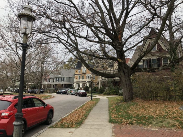
Breed’s Hill and Bunker Hill, Charlestown
History buffs may be interested to know that the Bunker Hill Monument is actually on Breed’s Hill, with Bunker Hill being located just to the west, but putting that aside for a second, the sections of the two hills between Main Street and Bunker Hill Street are filled with tree-lined lanes complete with gas lamps, charming old row houses that look much like those on Beacon Hill, occasional views of the Zakim Bridge and the Boston skyline in the distance, and of course, the monument itself. Combine all of this with a lack of car and foot traffic and you will see why this is such an ideal spot for a leisurely stroll.
Nearest Subway Stop: Community College (Orange Line)
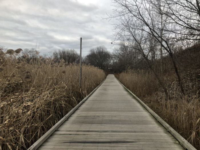
Alewife Brook to Mystic River, Arlington, Cambridge, Somerville, Medford
A linear walk with water along its entire length, this easy, flat route quickly takes you away from the hectic Alewife Station area and into a peaceful area of woods, boardwalks, and wetlands via the little-known Alewife Brook Greenway. The northern end of this path brings you to Mystic Valley Parkway near where Arlington, Medford, and Somerville meet, and from there you can cross the street and follow another path westward along the Mystic River all the way to the start of Lower Mystic Lake where you can either turn around or walk to Arlington Center and take the Minuteman Bike Trail back to the T station.
Nearest Subway Stop: Alewife (Red Line)
Dorchester-Milton Lower Mills Industrial District and Milton Hill Historic District
This is another fascinating walking spot for history fans, as the Lower Mills neighborhood is full of old factories and warehouses that have been renovated into residential and commercial developments, while just up the hill from Milton Village is Milton Hill, which has some of the most beautiful old homes you’ll see in the entire region. Water views abound here as well, from hilltop scenes of the Neponset River at Governor Hutchinson’s Field on Milton Hill to the raging rapids of the river in Lower Mills, and a peaceful cove-like part of the river can be found in Milton Landing, which is hidden behind Milton Village.
Nearest Subway Stop: Milton Village (Red Line)
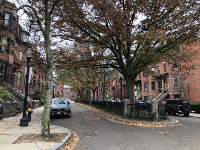
British-Style Squares Off Columbus Avenue, South End
Few cities in the United States have more of a European feel than Boston, and the city’s South End neighborhood proves this point pretty well. And on either side of Columbus Avenue are “squares” that are basically side streets with narrow village greens down the middle of them, which, combined with the attractive Victorian row houses, look an awful lot like some parts of London. Braddock Park, Rutland Square, and Concord Square are three such spots that you’ll want to check out along with neighboring streets without greens but with just as much charm.
Nearest Subway Stops: Back Bay or Massachusetts Avenue (Orange Line)
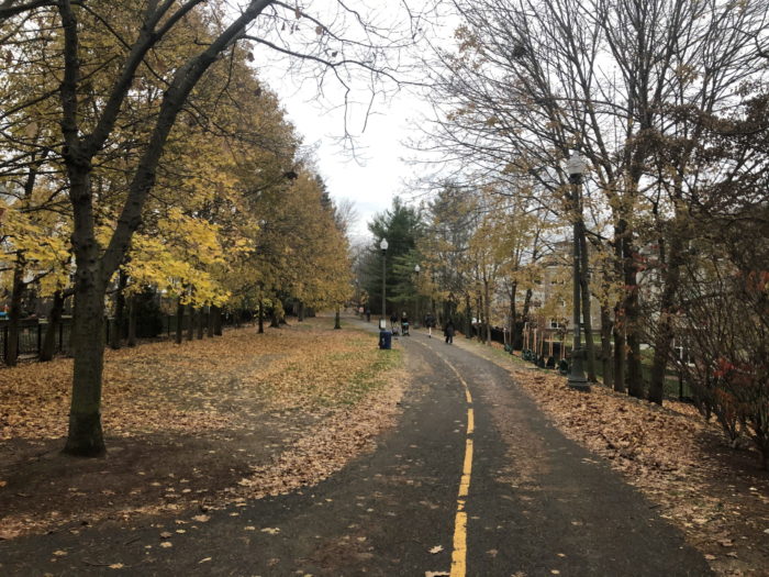
Somerville Community Path and Cambridge Linear Park
Somerville’s Davis Square area and neighboring North Cambridge don’t have much in the way of green space, but a real gem of a linear trail can be found that runs from Lowell Street east of Davis Square to the Cambridge border where it becomes the Cambridge Linear Park and goes all the way to Alewife Station. Along the path you’ll see tiny park areas, renovated industrial buildings, and an interesting mix of homes, and even though it cuts through some busy sections of Somerville and Cambridge, much of it is very quiet considering how close it is to Mass Ave, Holland Street, Highland Street, and Elm Street.
Nearest Subway Stops: Davis Square or Alewife (Red Line)
Columbia Road Section of the Old Harbor Reservation Parkways, South Boston
This is a bit of an odd one, but it makes for a great walk with little in the way of traffic while the water views are endless. The section of Columbia Road that cuts through Roxbury, Dorchester, and the western edge of South Boston is a major thoroughfare, but once it intersects Day Boulevard by Carson Beach in Southie, it inexplicably shifts to the left and parallels Day Boulevard all the way to City Point, basically becoming a sort of narrow frontage road with little traffic and huge old single- and multiple-family homes, many of which feature large porches where residents can enjoy water views across the way.
Nearest Subway Stops: JFK/UMass or Andrew (Red Line)
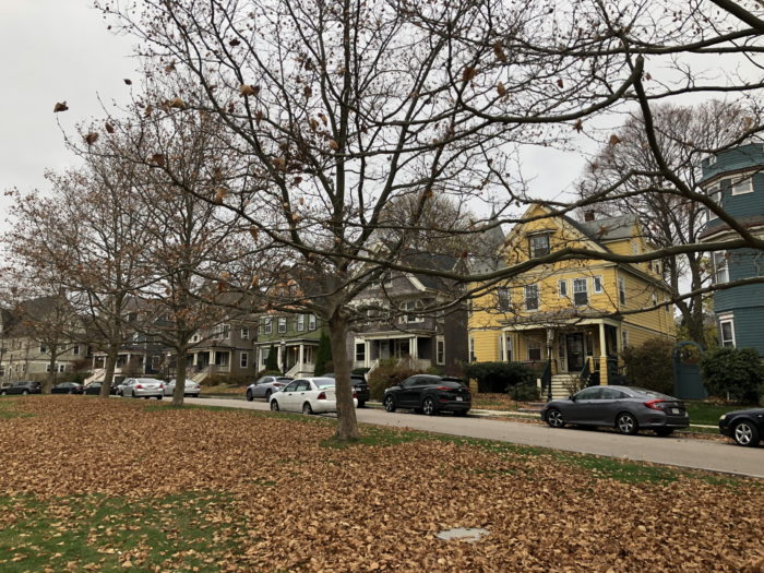
Wellesley Park, Dorchester
You’ll never know what you might find while wandering through Boston neighborhoods, and this little oasis near busy Dorchester Avenue almost doesn’t seem real in some respects. Having much in common with the aforementioned squares of the South End, Wellesley Park includes an expansive village green with gorgeous Queen Anne and Victorian homes on either side, while gas lamps and huge trees add even more charm. While not a long street, some of the nearby roads, such as Melville Avenue, Paisley Park, Upland Avenue, and Centervale Park, are also very nice, making for a walk of decent length that’ll whisk you away from the hustle and bustle of Fields Corner just down the road.
Nearest Subway Stops: Shawmut or Fields Corner (Red Line)
Cottage Farm Historic District, Brookline
The first time you cross over from the densely populated Fenway/Audubon Circle part of Boston into this tiny pocket of Brookline, your first reaction may be of disbelief, because you almost instantly enter a remote-feeling, heavily wooded area with huge houses spaced far apart from each other. The Cottage Farm district, which is basically wedged between Comm Ave, Park Drive, Beacon Street, and Amory Street, used to be a huge meadow many years ago. Some open space can still be found here, including the bucolic Hall’s Pond Sanctuary and Amory Woods, which you can use to extend your walk through this jewel of a neighborhood.
Nearest Subway Stops: Several along the B and C branches (Green Line)
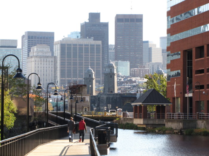
Kendall Square to Beacon Hill, Cambridge and Boston
Cambridge’s Kendall Square and Boston’s Beacon Hill are very different places, so it’s easy to overlook the fact that they are only minutes apart from each other and can be combined into a rather fascinating walk with little in the way of crowds. The former is a high-tech center and a bit of an urban canyon that’s particularly quiet these days with so many people staying at home during the pandemic, while the latter is easily one of the most charming neighborhoods in Boston, and the two are connected via the recently renovated Longfellow Bridge, complete with great views of both cities. And both neighborhoods have narrow side streets that are perfect for leisurely walks.
Nearest Subway Stops: Kendall/MIT or Charles (Red Line)
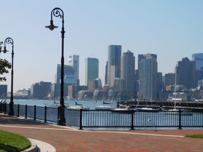
Jeffries Point, East Boston
Much of Eastie is busy and congested, but there are parts here and there where you can get away from it all, including this laid-back neighborhood that faces downtown Boston just across the water. The “inland” section of Jeffries Point sits on a hill with some beautifully restored row houses and stunning views of the city, while the waterfront includes the equally stunning Piers Park and the adjacent Boston Harbor Shipyard and Marina, and all of these areas are close enough together to make for an easy and relatively short walk—and for those with cars, parking is mostly easy to come by.
Nearest Subway Stop: Maverick (Blue Line)

Marc is the founder of @hiddenboston, a textbook editor, a hike leader for @AppMtnClub, and a food and travel writer and commenter for DigBoston, NBC/NECN, WBZ, WMFO and indie617.