ALL PHOTOS BY MARC HURWITZ
Get a sense of what so many rivers looked like hundreds of years ago before development changed the landscape
You don’t have to go very far outside of the city to get into some real wilderness, and this is certainly the case when heading south of Boston. The vast area between Routes 3 and 24 includes some beautiful unspoiled places, including a waterway few have heard of which happens to be one of the only free-flowing rivers in the entire state.
The Indian Head River in Hanover, Hanson, and Pembroke feels like the type of remote spot that you might find in Northern New England, and if you have a car it takes very little time to get to from the Boston city limits.
A map of the South Shore hints at the rich history of the region, with Native American names for cities, towns, and neighborhoods along with parks, ponds, and rivers (including some very familiar ones like Wompatuck, Ponkapoag, Neponset, Sagamore). Another one that you may come across is Massachusett, a tribe whose name is where the state got its name, and who lived mostly south of present-day Boston including by the Indian Head River. Over the past few centuries, the waterway became the site of factories, mills, and dams, but today, it is slowly returning to what it used to be like before development.
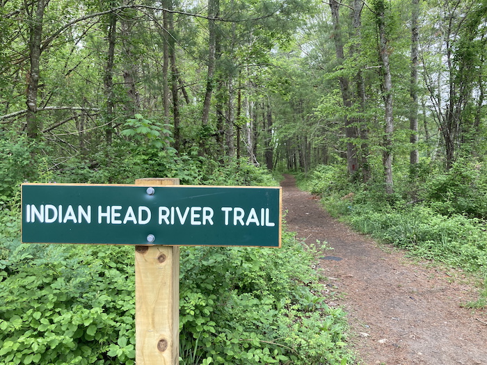
There are several places you can start a hike along the Indian Head River, but perhaps the best one is at the parking lot for Luddam’s Ford Park, a peaceful recreation area on Elm Street by the Hanover/Pembroke line just off Route 53 (and less than 10 minutes from Route 3). A flat, wide trail begins on the north side of the river, following an old railroad bed just south of Water Street; even before the path starts, it’s worth wandering around the park for its placid views of the water and woodlands surrounding it.
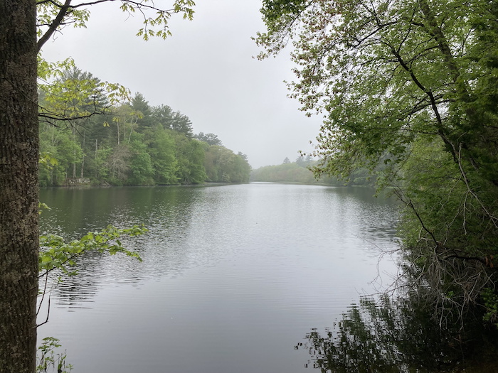
The Indian Head River Trail heads generally west with views of the river here and there, including from a short spur path about a half mile in, and a sign describing what a free-flowing river is can be found along the trail here. So what, you may ask, is a free-flowing river? To put it simply, it is a river that flows unobstructed and isn’t altered by dams or any other human-made structures. This particular section of the Indian Head River is indeed free-flowing, and standing on the rocks overlooking the moving water at the end of the spur path, you can get a sense of what so many rivers looked like hundreds of years ago before development changed the landscape.
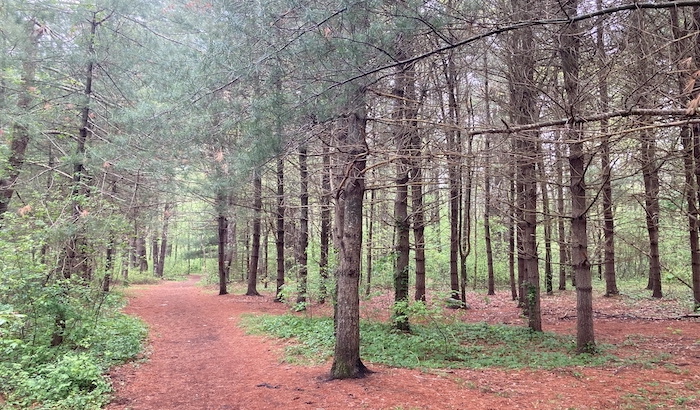
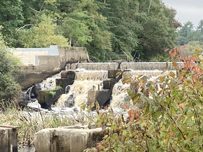
A short distance west of the spur path, the Indian Head River Trail emerges from the woods at Water Street and here you’ll find the old Waterman Tack Factory, which made tacks for shoes, furniture, and more in the 1800s and is now an historic site where you can still see parts of the dam that supplied power to the factory. The trail follows the old railbed for a spell before veering away from Water Street, taking a left turn into the woods and getting down to its banks of the river a couple of times before rising high above the waterway which can be seen through the woods.
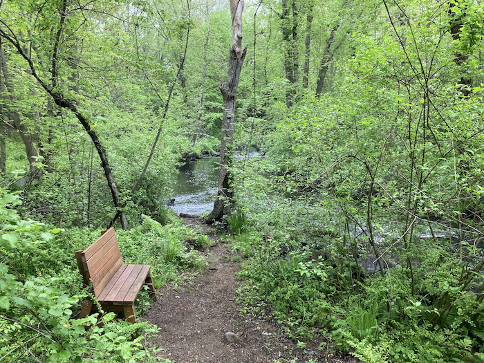
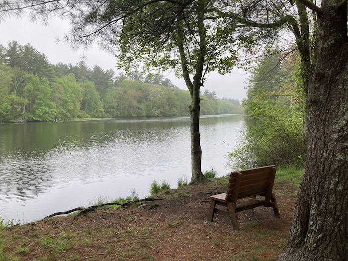
At about the halfway point of the hike (about two miles in), the trail emerges from the woods again, this time at Broadway in South Hanover, briefly following that road before going left again on Cross Street and going over a bridge at the Hanover/Hanson line; but just before you cross the river, take a left down a little dead-end path for views of cascading waters under the bridge and the slower-flowing river beyond. Whether you sit on the rocks or a bench at this glorious spot, it’s a great place for reflection only a few yards from civilization.
The Indian Head River Trail continues along the other side of the river after the bridge, where you take a left and quickly discover that the trail on this side is quite a bit different from that of the first half of the hike. Here, you’ll deal with more rugged and hilly terrain while occasionally catching a glimpse of the water from the deeply wooded path. This section is called the Rocky Run Conservation Area, which leads from Hanson into Pembroke and into the Tucker Preserve where the river runs through a pristine gorge with some of the best views of the entire hike. It is worth continuing along the water here, but for a different experience (and make sure you’re using a GPS-based app so you don’t get lost), it can be fun to wander into the woodlands of this quiet area before looping back to the river’s edge and returning to Elm Street—which is called W Elm Street on the Pembroke side.
Just before crossing the bridge and returning to the parking lot on the other side, head over to the river where you’ll see something that is a rarity in the Greater Boston area—a fish ladder. The Indian Head River goes under Elm Street and eventually flows into the North River which continues on into the Atlantic Ocean where Scituate and Marshfield meet, and fish such as herring and shad migrate upstream to the ladder in the spring in order to spawn. The stone bridge on Elm Street is just downstream from the ladder and includes an ancient plaque that mentions “The Bay Path at Luddam’s Ford Across the Indian Head River” while also showing the border where Hanover and Pembroke meet, and the view of the river continuing on from this point is breathtaking, especially in the fall.
It’s hard to believe that the Indian Head River and its corresponding path are so utterly unknown to even the most knowledgeable of hikers in Eastern Massachusetts, but that’s part of what makes the area so special. All it takes is a drive of 25 miles from downtown Boston to get to this special spot, which feels a million miles away from the traffic jams and crowds of the city.
Indian Head River Trail Information: nsrwa.org/listing/indian-head-river-trails/
AllTrails map of this hike: alltrails.com/explore/recording/indian-head-loop-hanover-ec8b57b

Marc is the founder of @hiddenboston, a textbook editor, a hike leader for @AppMtnClub, and a food and travel writer and commenter for DigBoston, NBC/NECN, WBZ, WMFO and indie617.